Blogs usually share findings and opinions. I wish this were another such blog! It would then be called Geodata for Intermediate Geeks: How to collect, manage and use your own placemarks. My problem: I have more questions than answers. My logic: We are in the very beginning of wide spread use of geodata. We have the technology that could simplify everyday life for any mobile person, in business and pleasure, but we fail to use it. We don’t know what apps and tools to use, we don’t understand the legal aspects, we don’t know what’s possible. I would like to change that! Hence, I set out to structure a set of requirements, needs, and questions. Basically, I want an ecosystem around placemarks (POIs, points of interest), much like around photography. I want a repository of placemarks, on my own hard disk and in my sole ownership. I want to know the proper formats, web services, mobile apps that support my requirements on ownership, openness, tagging, mobility, roaming, relevance, redundancy, management, and sharing. 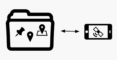
The use case: How I want to use placemarks (and maps)
Everyone is a special case, but I don’t believe I’m all that special:
- I travel on business, frequently to the same places.
- I meet friends and relatives, usually in the same places.
- I explore new places, often close to already visited places.
- I travel by air, train, bus, tram, car, or on foot. Or I do sports, on a bike, on skis, in a kayak, or on foot.
That has been the case for decades. But this is new:
- I carry a mobile device with me, that knows where it is.
- I take pictures, often with a camera that geotags the picture.
Although technology has improved, I tend to be as confused as ever, not using location awareness properly:
- I frequently forget the locations of places I visit less than once a year, yet there are so many such semi-frequent locations, that I go to some of them each month. I spend time being lost.
- I often don’t make the mental connection between geographically adjacent places, even if they’re familiar. I waste opportunities.
- In new places, I don’t know how far it is yet to go, in what direction (as the crow flies). I lose time and become distracted.
“Kaj, go get a GPS – a Tom-Tom, a Garmin, whatever!”, you might say. No thank you. I don’t want yet another device, to charge, to drag along. A car isn’t my prime means of transport, and even in a car, I don’t want a distractive voice interrupting my thinking. What I want on the route is a non-intrusive app that tells me how far it is to places that are of relevance to me – ideally on a map, but just knowing it’s 14 km away, slightly to the right as the crow flies, is just fine. But my location-aware needs aren’t limited to a mobile app.
My placemarks are mine, just like my pictures
The Internet is full of photos, just as a map is full of place names. What’s most relevant to me are my own photos and my own placemarks. Sure, if I go to a place I’ve never been, I may take a look at pictures in travel books. But I devote lots of time to taking pictures, selecting the most memorable ones, giving them tags and descriptions, sharing them with friends. I have tools for managing them (Lightroom on my laptop works great for me), I have tools for showing them on my mobile device (I merely sync a set of folders created with Lightroom), and I even publish some of them for others to see (on various social media). I don’t see why I should behave any differently with my place marks. Certain placemarks are highly relevant for me, but totally irrelevant for you. Where I live. Where I work. Where I spend my summers. Where my friends and relatives live. Where I usually go skiing. Where I plan to go on my next kayaking trip. My question is: How do I best manage these placemarks, on my own hardware? How do I collect them, curate them, manage them, keep them with me on my mobile device, share some of them with others?
The placemarks are already captured, but siloed and not managed
I have quite a number of placemarks stored here and there. While I hate nagging GPSes, I have used them at times, and stored some places there. I have used Google Earth, and entered place marks in “My Places”. Most of all, I have taken lots of geotagged pictures, with my phone, and with a couple of other cameras that know where they are – meaning that Lightroom knows things. And, in my particular case, I do a lot of outdoor sports that I track using a tiny Columbus V-900 GPS tracker, which doesn’t tell me where I am, but does tell me where I was. I have quite a few tracks from kayaking, skiing, hiking, biking, walking and even just tourist walks recorded for matching with pictures taken on cameras that lack a GPS. And some of the tracks even reside in an old MySQL database.
My requirements on the Placemark ecosystem
Now having painted the general picture, I’m ready to move on to the requirements. This isn’t a list of requirements on a single mobile app or web service, much like my photography needs aren’t met by a single app. My photography requirements are matched by a set of devices (cameras, accessories, hard disks), web services, laptop apps and mobile apps; my placemark requirements are similar in nature.
- Ownership: I want to own my own placemarks. I don’t want them to be owned by any individual provider of map services. I want to keep my sensitive location data on my own hard disk, and portion out them onto the cloud by active and careful choice.
- Openness: I want to move my placemarks around, between devices, apps and services.
- Tagging: I want to categorize my placemarks based on the personal area of usage.
- Mobility: I want to be able to use all my existing placemarks anytime from mobile devices. Unless I attach a pic to it, a placemark requires a tiny amount of bytes.
- Roaming: I want full access to my placemarks without roaming. Distances and directions can be shown full well without maps, thank you very much.
- Relevance: I want more relevant placemarks to be given priority over less significant ones, in user interfaces and other contexts.
- Redundancy: I want to capture new placemarks easily, yet avoid unnecessary duplicates.
- Management: I am ready to spend time indicating the relevance of placemarks, and tagging them, using well designed software.
- Sharing: I would like to share some of my placemark collections with others, who share my interests, hobbies, needs. Some of that data I am ready to release for free use in the public domain.
- Taxonomy: For placemarks I want to share with others, I may be ready to tune my tagging system into a hierarchy – so that others can make better sense of my shared placemarks.
My questions – in analogy to photography
- What is the format? How do I share my placemarks with you, in a reasonably open, non-proprietary format? Is KML the JPG of placemarks? Should I go GeoJSON?
- What are the web services? On which map sites do I best display my placemarks? And enter new placemarks? How do I avoid being trapped in legal issues? I can live with others sharing the right to use my placemarks, but I cannot live with limitations on my own use of my own placemarks. How do I export and import my placemarks into these webservices?
- What should be my placemark repository? What is to placemarks as Lightroom is to pictures? I need a place where I can keep my placemarks, sort them, tag them with various tags, categorize them. Ideally an Open Source app – but proprietary is OK if the application fills my other requirements. MariaDB is certainly a good candidate for the underlying database, but I’m not so keen on writing the CREATE statements, nor design the app logic myself.
- How do I export placemarks from Lightroom? I don’t want one placemark for each picture, but I do want to fill my placemark repository with data from my pictures – as they tend to reveal my most relevant placemarks.
- What are the mobile apps? Which app should I use to show my placemarks? Can I use the same app to collect new ones? Can it harvest placemarks from pics already taken with my mobile? How can I visually show my placemarks when I don’t have Internet?
As said, I have more questions than answers. If I get good answers, I may yet publish the blog I’d really like to write: “Geodata for Intermediate Geeks: How to collect, manage and use your own placemarks”.